
Sfruz · Predaia · Trentino
Trekking in Val di Non
A curated selection of the valley’s finest walking and hiking trails
The cards follow the downloadable tracks. Distances and elevation gain are approximate; durations refer to snow-free conditions. Variations and different starting points can change these figures.
Before a winter outing
The hiking routes and walking times describe snow-free conditions. Snow, ice and closures can change access and difficulty. Check the weather, avalanche bulletin and local advice, and choose an open route suited to your experience. Local guides can help you plan a snowshoe outing.
Winter in Val di NonTrekking in Val di Non: a guide to the best scenic routes
Val di Non is a true paradise for hikers, offering everything from gentle family strolls to rewarding mountain adventures. Beyond its renowned apple orchards, the valley unveils a rich variety of landscapes: deep canyons carved by ancient rivers, alpine lakes such as the iconic Lake Tovel, and spectacular views of the Brenta Dolomites.
👨👩👧 Easy Walks for Families
- Lake Tovel Loop: A classic, gentle walk in the Adamello Brenta Nature Park.
- San Romedio Rock Path: A unique walkway carved into the rock leading to the legendary sanctuary.
- Lezi Paths: Historic irrigation channels now transformed into easy panoramic trails.
🏰 For History & Culture Lovers
- Walk to Castel Thun: A relaxing trail through woodland leading to one of Trentino’s most captivating castles.
- Minor Castle Routes: Itineraries exploring hidden gems such as Castel Belasi and Castel Bragher.
🌄 For Panoramic Views & Adventure Seekers
- Predaia – Corno di Tres Loop: A ridge-top itinerary offering sweeping 360° views.
- Proves / Maddalene Alpine Huts Tour: A scenic route across peaceful high pastures.
📊 Trail Summary
A quick overview of the main routes with key technical details.
Lake Tovel Loop
- Difficulty: Easy
- Length: ≈ 4.1 km
- Ascent: ≈ +251 m
- Duration: ≈ 1:30 h
- Highlights: Lake, Adamello Brenta Park
- Ideal for: Families, nature
San Romedio Rock Path
- Difficulty: Easy
- Length: ≈ 5.2 km
- Ascent: ≈ +517 m
- Duration: ≈ 1:45 h
- Highlights: Canyon, sanctuary, irrigation canal
- Ideal for: Families, spirituality
Merlonga Walk
- Difficulty: Easy
- Length: ≈ 4.5 km
- Ascent: ≈ +181 m
- Duration: ≈ 1:30 h
- Highlights: Coredo & Tavon Lakes, San Romedio
- Ideal for: Short walks
Walk to Castel Thun
- Difficulty: Easy
- Length: ≈ 2.1 km
- Ascent: ≈ +140 m
- Duration: ≈ 0:45 h
- Highlights: Castel Thun, ruins of S. Pietro, orchards
- Ideal for: Families, history
Predaia Alpine Huts Loop
- Difficulty: Medium
- Length: ≈ 7.9 km
- Ascent: ≈ +368 m
- Duration: ≈ 2:30 h
- Highlights: Alpine huts, Roccia Larga viewpoint, Dolomites
- Ideal for: Views, local food
Predaia – Corno di Tres Loop
- Difficulty: Medium
- Length: ≈ 9.6 km
- Ascent: ≈ +631 m
- Duration: ≈ 3:30 h
- Highlights: Sentiero Italia, panoramic ridge
- Ideal for: Expert hikers
Monte Peller Loop
- Difficulty: Medium
- Length: ≈ 10.7 km
- Ascent: ≈ +483 m
- Duration: ≈ 3:30 h
- Highlights: Rifugio Peller, Malga Tassulla
- Ideal for: Panoramas, experienced hikers
📸 Photo Gallery

Panoramic walk along the shores of Lake Tovel, in the very heart of the Adamello Brenta Nature Park.
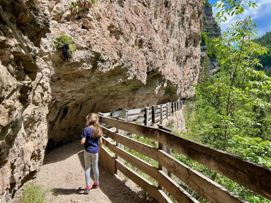
A spectacular path carved into the rock, winding through the canyon towards the mystical Sanctuary of San Romedio.
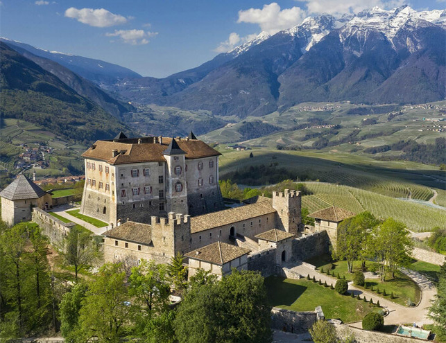
A beautiful walk climbing through apple orchards to the impressive Castel Thun, guardian of centuries of Trentino history.
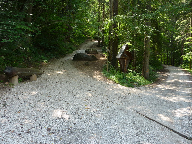
A relaxing route towards San Romedio that allows you to immerse yourself completely in nature.

A rewarding hike along the beautiful mountain ridge that separates the Adige Valley from the Val di Non.
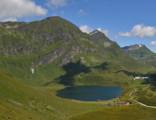
A panoramic excursion along the trails of the Maddalene range, among alpine pastures and tranquil mountain silence.

A lovely circular walk with gentle gradients linking the Predaia mountain huts to the Roccia Larga viewpoint.

A hike around the summit of Monte Peller, at the northern edge of the Brenta Dolomites.

A comfortable, almost flat path with many panoramic viewpoints over the lakes and the Sanctuary of San Romedio.
Casa Predaia · Sfruz
Book directly with us
Tell us your dates, number of guests and preferred apartment. You will speak directly with your hosts and receive a proposal for your stay.